

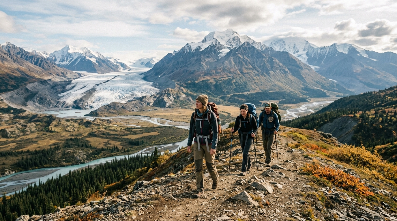
Wrangell-St. Elias National Park is the largest national park in the United States, yet it remains one of the least visited places in the country. Because the park covers millions of acres of wild land, experiencing it on foot is very different from walking on a paved trail in a smaller, more urban park. Most visitors find that hiking in Wrangell St Elias National Park involves vast open spaces, towering peaks, and extreme remoteness where help is hours away.
Planning a trip here requires looking past standard park maps and understanding the true scale of the wilderness. Travelers must prepare for changing conditions, rugged routes, and unique logistical hurdles that do not exist in more developed national parks. Knowing what to expect makes the difference between a successful adventure and an overwhelming experience.
The Reality of Off-Trail Trekking in Alaska’s Backcountry
Hiking in Wrangell St Elias National Park means navigating true backcountry wilderness because the park has very few maintained trails.
Most people picture national parks as networks of clear, well-signed paths with regular foot bridges and clear trailheads. Wrangell-St. Elias National Park operates much differently, offering mostly unmarked terrain where hikers must rely on map reading, compass skills, and GPS devices. Trail maintenance happens in only a few small areas, such as around the historic mining towns.
Walkers traversing the backcountry often find themselves pushing through thick brush, walking across loose rock fields, and picking their own routes across open tundra. This style of travel demands strong physical endurance and a high comfort level with isolation. Anyone planning to explore the park on foot needs to be entirely self-sufficient.
Exploring Accessible Glaciers and Historic Mining Hubs
The most accessible regions for hiking in Wrangell St Elias National Park center around the historic communities of McCarthy and Kennicott.
Travelers who want a classic glacier experience often head toward the Root Glacier, which sits just a short walk from Kennicott. Walking on the glacier requires sturdy boots, and many visitors choose to strap on microspikes or crampons for better traction on the ice. The Root Glacier trail provides a rare chance to see blue meltwater pools, deep crevasses, and dramatic ice formations up close without needing extreme mountaineering skills.
Another popular option is the Erie Mine route, which leads hikers up past old mining ruins and offers sweeping views of the surrounding valleys. These localized routes give a taste of the park’s rugged beauty while staying relatively close to base camps and local guide services. Beyond these few hubs, however, the landscape opens up into millions of pathless acres.
For a broader look at regional attractions beyond the footpaths, check out our guide on things to do in Wrangell St Elias National Park.
Road Conditions, Glacial Rivers, and Other Practical Hazards
Exploring this massive Alaskan landscape comes with practical limitations, physical hazards, and strict safety realities that every visitor must respect.
The primary route to the main visitor areas is the McCarthy Road, a bumpy, unpaved gravel road famous for sharp rocks that easily puncture vehicle tires. Drivers must carry multiple spare tires and drive very slowly to avoid costly mechanical trouble in a remote location. Cell service is virtually nonexistent across almost the entire park, meaning regular smartphones will not work for emergency calls or navigation.
River crossings present another major danger because glacial melt swells rushing streams during warm summer afternoons. Stepping into fast, ice-cold water can lead to dangerous situations, so timing crossings for early morning when water levels are lower is a common safety strategy. Weather can also shift instantly from bright sunshine to heavy rain and high winds, making proper rain gear and warm layers mandatory.
Federal Land Guidelines and Official Park Regulations
Checking guidelines from the National Park Service is essential before starting any backcountry trek in the region.
According to the National Park Service, day hikes do not require permits or advance registration, but extended backcountry trips require careful planning and voluntary registration for safety. The park allows sport hunting in designated areas under state and federal regulations, so hikers should wear bright colors during hunting seasons. Campers must follow Leave No Trace principles strictly, packing out all trash and storing food securely to prevent wildlife conflicts.
Park rangers at the Copper Center visitor center or the McCarthy road station provide the latest updates on trail conditions, bridge washouts, and river levels. Consulting official federal resources ensures that travelers have accurate details on land ownership, since private mining claims still exist within the park boundaries.
Common Questions About Hiking in Wrangell St Elias National Park
Do I need a guide for hiking in Wrangell St Elias National Park?
Day walks near Kennicott and the Root Glacier are easy to do independently, but remote backcountry treks or glacier crossings often require a certified guide for safety. Hiring a local guide helps manage complex navigation, river crossings, and changing weather conditions.
How do I get to the main hiking areas?
Most visitors drive down the unpaved McCarthy Road or take a small flight from towns like Anchorage or Glennallen. Renting a standard vehicle can be risky due to rough road conditions, so many travelers rent specialized vehicles or use local shuttle vans.
Are there bears in the park?
Both black bears and grizzly bears live throughout the entire park region. Hikers must carry bear spray, know how to use it, and store all food and scented items securely in bear-resistant containers.
What time of year is best for visiting?
The peak summer season runs from June through August when weather is warmest and days are long. May and September offer quieter experiences, but freezing temperatures, snow, and limited facility hours are common.
Is cell service available on the trails?
Cell service is practically nonexistent inside the park boundaries. Visitors should bring a satellite messenger or personal locator beacon for emergency communication.
Disclaimer: Park conditions, weather patterns, and access rules can change rapidly in remote areas. Always verify current safety alerts and regulations with the National Park Service before your trip.

I’m Muhammad Ubaid, founder of YBR Magazine. I research and write detailed guides on America’s National Parks — covering entry fees, permits, best times to visit, and planning tips — using official NPS sources and up-to-date information.

