

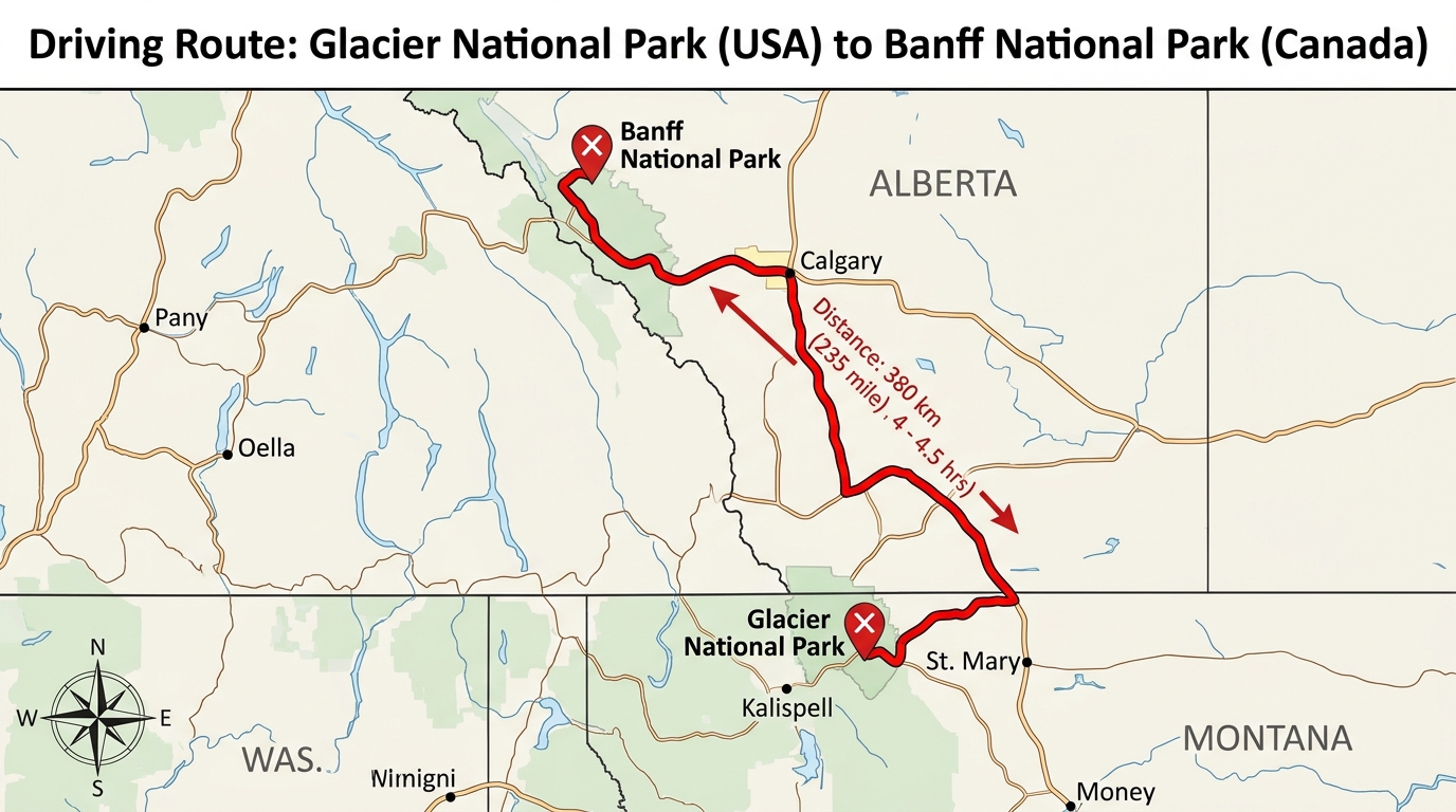
Planning a mountain journey across two countries requires careful attention to remote highways and changing customs rules. Travelers wondering how far Glacier National Park is from Banff are usually mapping out a grand international road trip through the northern Rocky Mountains. Connecting Montana to Alberta means crossing an international boundary, managing two separate currency systems, and navigating high-altitude mountain terrain.
Quick Answer on Distance and Drive Time: Driving between Glacier National Park in Montana and Banff National Park in Alberta usually covers about 400 to 450 miles, taking roughly 7 to 9 hours of uninterrupted driving time depending on your exact starting point and highway choice.
Choosing the US-93 and Highway 2 Route Through the Northern Rockies
Choosing the US-93 and Highway 2 route through the northern Rockies determines which scenic towns and mountain passes you will see along the way.
Most travelers leaving Glacier National Park head north toward the Canadian border via US-93 or regional border crossings in Alberta and British Columbia. Once across the international border, drivers typically connect to Canadian Highway 2 or Highway 2A before moving west toward Calgary and joining the Trans-Canada Highway. This northern stretch offers sweeping views of the Canadian foothills and gradual climbs into the mountain ranges. Keeping a physical road map or downloaded GPS data is crucial because mobile phone service can drop off completely in remote stretches of the highway. For those interested in exploring more scenic driving routes in the wider West, checking out our Flathead Lake to Glacier National Park travel itinerary provides wonderful inspiration for regional road trips.
Clearing Customs at the Montana and Alberta International Border
Clearing customs at the Montana and Alberta international border requires every passenger to carry proper identification before leaving the United States.
Because this international route transitions from Montana into Alberta, drivers must pass through official ports of entry staffed by customs officers. Every traveler needs a valid passport, passport card, or an approved Western Hemisphere Travel Initiative document. Canadian border agents routinely ask about the purpose of the trip, how long visitors plan to stay, and whether anyone is carrying prohibited items like specific agricultural products or firearms. Being prepared with clear answers and easily accessible documents helps minimize wait times at the checkpoint.
Navigating Seasonal Snow Closures on Alpine Passes and Park Roads
Navigating seasonal snow closures on alpine passes and park roads dictates whether your chosen driving path remains open throughout the year.
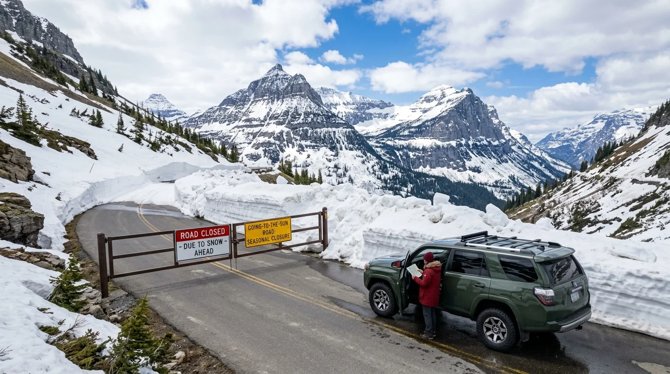
High-elevation routes in both Montana and Alberta receive heavy snowfall that can linger well into spring or return early in the autumn months. Glacier National Park features iconic alpine roads like the Going-to-the-Sun Road, which typically stays closed until late June or early July due to massive snowdrifts. Similarly, heavy winter storms across the Canadian Rockies demand cautious driving, and vehicles may be required by local law to carry winter tires or chains during designated snow hazard periods. Checking official provincial and state transportation websites before departure prevents unexpected detours.
Budgeting for Separate United States and Canadian Park Pass Systems
Budgeting for separate United States and Canadian park pass systems means visitors must plan for entry fees in both the United States and Canada.
A United States National Parks pass, such as the America the Beautiful interagency card, provides zero admission value inside Canadian national parks. Likewise, a Parks Canada Discovery Pass does not cover entry or vehicle fees inside Glacier National Park in Montana. Travelers driving the full international route must purchase separate permits for each country to stay fully compliant with local conservation laws. Planning these park expenses into your travel budget ahead of time avoids confusion at park gates.
| Destination | Country | Required Entry Pass |
|---|---|---|
| Glacier National Park | United States | US National Parks Pass or Single Entry Fee |
| Banff National Park | Canada | Parks Canada Discovery Pass or Daily Visitor Fee |
Stopping in Lethbridge and Calgary to Break Up the Long Drive
Stopping in Lethbridge and Calgary to break up the long drive gives road trippers great places to rest, refuel, and stretch their legs.

Breaking the 400-to-450-mile journey into a two-day trip makes the travel experience much more relaxing and enjoyable. Communities like Lethbridge, High River, or the outskirts of Calgary offer comfortable hotels, grocery stores, and local dining options. Stopping at viewpoints along the Alberta foothills allows travelers to admire the dramatic transition where flat prairies meet towering mountain peaks. Taking your time along this corridor turns a long transit day into an unforgettable sightseeing adventure.
Disclaimer: Travel regulations, border wait times, park admission fees, and seasonal highway schedules change frequently. Always verify current details from official government and park websites before starting your journey.
How far is Glacier National Park from Banff in miles?
The driving distance between Glacier National Park and Banff National Park generally spans between 400 and 450 miles, depending on the exact highway route you choose.
How many hours does it take to drive between the two parks?
A direct drive typically takes 7 to 9 hours under normal weather conditions, though this estimate excludes border crossing wait times and stops.
Do I need a passport to cross from Montana into Alberta on this trip?
Yes, traveling between Glacier National Park and Banff National Park requires crossing an international border, meaning every passenger must present a valid passport or approved travel document.
Can I use my American national park pass at Banff?
No, United States national park passes are not accepted in Canadian national parks, so you must purchase a separate Parks Canada Discovery Pass or daily permit.
Are the main connecting highways open all year?
While major highways remain open year-round, high-elevation mountain passes and park roads often experience seasonal winter closures and weather delays.
What is the best month to plan this international road trip?
July and August provide the most reliable weather, fully open mountain passes, and optimal daylight hours for long-distance driving.

I’m Muhammad Ubaid, founder of YBR Magazine. I research and write detailed guides on America’s National Parks — covering entry fees, permits, best times to visit, and planning tips — using official NPS sources and up-to-date information.

