

Finding the Closest Airport to Great Basin National Park
Finding the closest airport to Great Basin National Park requires looking at a map of vast rural distances because eastern Nevada contains no major commercial airports. Great Basin National Park sits in a very isolated corner of the state, far away from large metropolitan areas and busy flight hubs. Travelers cannot simply book a short flight to a nearby airstrip and catch a quick ride to the park entrance. Instead, visitors must choose between flying into major regional cities several hours away or exploring tiny local airstrips with very limited options. Understanding these geographic realities helps travelers plan realistic itineraries without running into unexpected travel delays or long, exhausting car rides.
Because Great Basin National Park is so remote, the journey demands careful preparation regarding rental cars, fuel stops, and driving times. When planning a trip, many travelers also review resources such as our Best Time to Visit Great Basin National Park guide to ensure high-elevation roads are open when they arrive. The park itself features stunning underground limestone formations, ancient bristlecone pine groves, and towering mountain peaks that rise sharply from the desert floor. Reaching these natural wonders safely starts long before arrival, beginning with the choice of where to land the airplane.
Salt Lake City to Great Basin National Park and Other Major Options
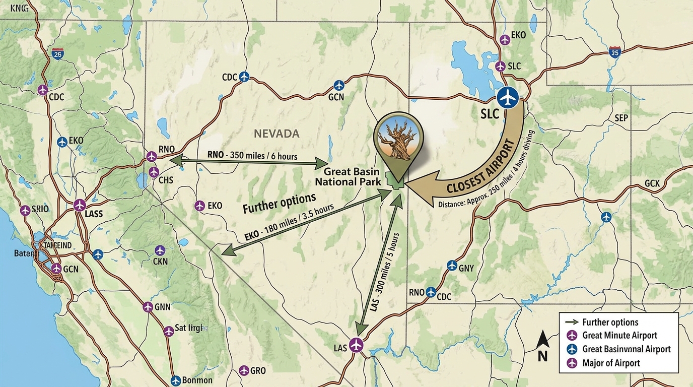
Salt Lake City to Great Basin National Park represents the most popular and practical route for the vast majority of commercial airline travelers. Salt Lake City International Airport sits in neighboring Utah and provides hundreds of daily flights from major carriers across the United States. From the Salt Lake City terminal, drivers head south and west across rural highways for roughly four to five hours to reach the park entrance near Baker, Nevada. This route offers reliable rental car availability, numerous vehicle choices, and well-maintained interstate highways for the first leg of the drive.
Other major airport choices include Las Vegas McCarran International Airport and Reno-Tahoe International Airport, though both require significantly longer driving times. Driving from Las Vegas to Great Basin National Park typically takes around five to six hours heading north through rural Nevada. Reno sits a similar distance to the west, requiring a lengthy trek across the Loneliest Road in America. While these major hubs offer heavy flight frequencies, travelers must be prepared for long stretches of desert highway with limited services.
Smaller Regional Airports and Their Limitations
Smaller regional airstrips closer to the Nevada-Utah border generally lack the commercial flight schedules required by most long-distance vacationers. Local municipal airfields in rural Nevada and western Utah cater primarily to private planes, chartered flights, or very limited commuter services. Travelers searching for commercial airline tickets will usually find that these tiny regional facilities do not offer direct flights from major national hubs. Furthermore, securing a traditional rental car at these small airstrips is often impossible, as major rental agencies maintain their fleets only at large city airports.
Relying on a regional airstrip can also create complications if flight cancellations or weather delays occur. Because maintenance crews and replacement aircraft are scarce in rural Nevada, a delayed flight could disrupt an entire vacation schedule. Travelers who do manage to fly into a smaller regional airfield must arrange alternative ground transportation well in advance, as rideshare services and taxis are essentially non-existent in the Baker area. For most visitors, the convenience of a major international airport outweighs the shorter physical distance of a local airstrip.
Practical Downsides and Tips for the Drive
Driving across rural Nevada to reach the park involves real-world challenges like remote highways, scarce fuel stations, and dead zones for cell phones. Cell phone coverage drops out completely across large portions of eastern Nevada, making GPS navigation apps unreliable if downloaded maps are missing. Travelers must download offline maps, carry physical road atlases, and keep their vehicle gas tanks full whenever a station appears. Gas stations are few and far between along rural routes, and running out of fuel in the desert creates serious safety risks.
According to the National Park Service, visitors should also prepare for rapidly changing weather conditions, especially when driving up Wheeler Peak Drive to high mountain elevations. Summer afternoon thunderstorms bring sudden lightning, while spring and autumn bring freezing temperatures and unexpected snow squalls. Packing emergency food, extra drinking water, warm blankets, and a spare tire is essential for anyone tackling these isolated desert highways. Respecting the vast distances and preparing for vehicle self-reliance ensures a safer and much more enjoyable journey.
Frequently Asked Questions
What is the closest major airport to Great Basin National Park?
Salt Lake City International Airport in Utah is the closest major hub with extensive flight options, located about a four-to-five-hour drive away.
Can I fly directly into Great Basin National Park?
No, there are no commercial airports inside or immediately adjacent to the national park.
How long is the drive from Las Vegas to Great Basin National Park?
Driving from Las Vegas takes approximately five to six hours heading north through rural Nevada highways.
Are there rental car agencies at small regional airports near the park?
Major rental car companies typically do not operate out of the tiny local airstrips near the park, requiring travelers to rent vehicles in major cities.
Is cell phone service available during the drive from the airport?
Cell phone coverage is very spotty and drops out completely in many remote areas of eastern Nevada, so offline maps are necessary.
What precautions should I take for the long desert drive?
Keep your gas tank full, carry extra drinking water, download offline maps, and check weather forecasts before starting your trip.
Disclaimer: Travel times, flight schedules, and road conditions can change unexpectedly. Always verify details and safety advisories from official sources such as the National Park Service and state departments of transportation before your trip.

I’m Muhammad Ubaid, founder of YBR Magazine. I research and write detailed guides on America’s National Parks — covering entry fees, permits, best times to visit, and planning tips — using official NPS sources and up-to-date information.

