

Capitol Reef National Park stretches across a massive, wrinkled ribbon of earth known as the Waterpocket Fold, creating a geography that demands a very different travel mindset than more compact parks like Bryce Canyon. A well-designed Capitol Reef National Park itinerary must account for the reality that the park is broken into distinct zones separated by long, winding stretches of highway rather than a single walkable bowl. Travelers often make the mistake of underestimating how much time is lost driving between the central Fruita historic orchards and the deeply remote reaches of the northern and southern districts. Building a smart route means balancing your vehicle’s physical limits against the desire to see raw red rock monoliths without burning out behind the wheel.
Many standard travel guides lay out generic sightseeing lists that treat the entire region like a quick roadside stop off Utah State Route 24. They frequently gloss over the harsh truth of unpaved desert tracks, sudden flash flood dangers, and the complete lack of cellular signal that can strand unprepared visitors miles from assistance. This guide tackles those exact logistical gaps by offering a clear, honest breakdown of how many days you need, what each zone actually offers, and how to stay safe according to official guidelines from the National Park Service.
Deciding How Many Days in Capitol Reef National Park You Actually Need
Choosing the right duration for a Capitol Reef National Park itinerary comes down to whether you plan to stick exclusively to paved asphalt or tackle rugged backcountry dirt roads.
Most visitors find that spending two to three full days provides the ideal sweet spot for touring the paved scenic drive, walking popular desert trails, and sampling fresh pies in the historic Fruita district without feeling rushed. Attempting to see everything in a single day leaves you trapped behind the windshield on State Route 24, catching only fleeting glimpses of towering sandstone cliffs while missing out on deeper slot canyons. Conversely, dedicating four or more days opens up slow-paced exploration of remote backcountry loops like Cathedral Valley, though that extended timeline requires absolute patience and a high-clearance vehicle. Travelers should always check current weather forecasts and road status reports with the National Park Service before locking in their daily schedules, because summer thunderstorms or winter storms can render unpaved routes impassable overnight.
Navigating the Paved Heart of the Fruita District and Scenic Drive
The earliest stretch of your trip should center entirely on the accessible, paved core of the park where pioneer history meets sheer canyon walls.
Begin your morning by walking through the historic orchards of Fruita and stopping at the Gifford Homestead to inspect old timber structures and pick up locally baked fruit treats. Afterward, ensure you pay the standard vehicle entrance fee or display a valid pass as required by the National Park Service before turning onto the Capitol Reef Scenic Drive. This eight-mile paved corridor guides motorists past towering Navajo Sandstone formations and leads directly to short spur roads like Grand Wash and Capitol Gorge. You can easily spend several hours here stepping out of the car for flat, sandy walks between massive stone canyon walls before returning to the visitor center to review trail maps.
Tackling Classic Trailheads and Panoramic Canyon Overlooks
Your next phase of exploration shifts focus toward active exploration by foot, taking you up close to famous stone arches and sweeping canyon rims.
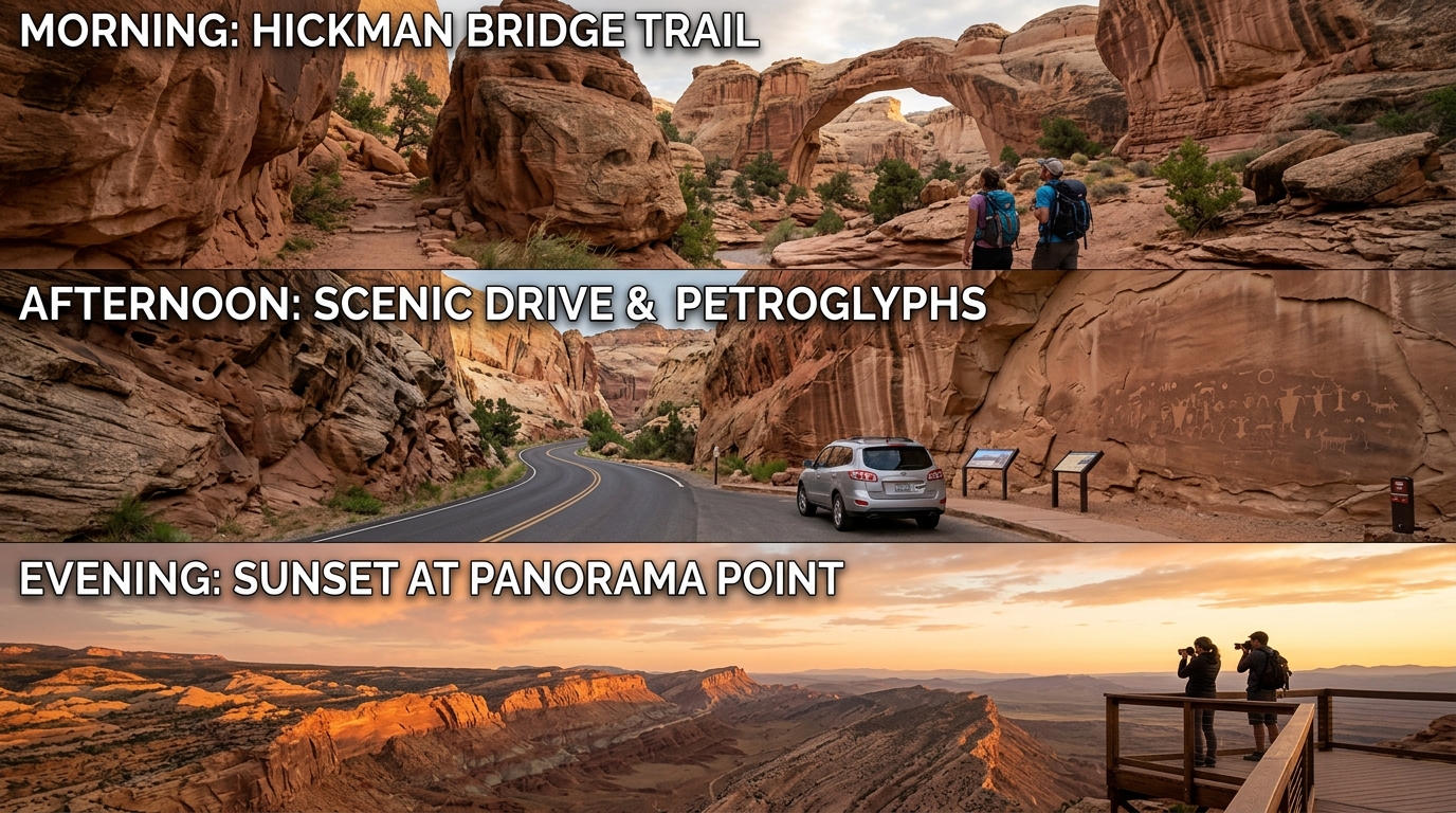
Start your morning very early at the Hickman Bridge trailhead to complete the popular two-mile round-trip journey leading to a massive natural sandstone span hanging high above the canyon floor. Carry plenty of drinking water in a secure daypack because the desert sun beats down relentlessly even during mild spring or autumn afternoons, and wear durable footwear with deep tread to handle loose rock. In the afternoon, drive westward along the highway to reach Sunset Point and Goosenecks Overlook, where short walking paths reveal dramatic, plunging views of the carved Fremont River below. If you want to expand your wider regional road trip with similar red rock landscapes, you can read more about building a solid Utah desert travel schedule through our guide on Canyonlands National Park Itinerary options.
Venturing Into the Remote Backcountry of Cathedral Valley or Burr Trail
The final phase of a thorough trip requires trading paved roads for high-clearance adventure in the park’s wild, untamed outer districts.
Before attempting any remote route, stop at the visitor center to consult park rangers about current road conditions, because recent rain or snow can transform dry clay into impassable sticky mud. Cathedral Valley demands a dedicated high-clearance vehicle with four-wheel drive to navigate deep sand patches, rough shale, and potential river crossings on a rugged loop featuring massive sandstone monoliths and glass mountains. If your vehicle lacks the clearance for Cathedral Valley, use your third day to drive the scenic Burr Trail Road toward the remote southern Waterpocket Fold instead, keeping a close eye on your fuel gauge since services do not exist out there.

Practical Logistics, Safety Rules, and Essential Gateway Planning
Understanding crucial park rules and infrastructural limitations will protect you from dangerous situations during your desert getaway.
Cell phone service is notoriously unreliable or entirely absent across almost all of Capitol Reef National Park, making it essential to download offline maps, trail descriptions, and weather radar before you leave your hotel. According to the National Park Service, domestic pets face strict boundary limitations and are banned from all dirt and paved hiking trails to safeguard native wildlife and prevent soil erosion in fragile biological crusts. Sudden flash floods pose a deadly threat in narrow slot canyons during afternoon thunderstorm cycles, requiring constant vigilance of local weather updates. For travelers looking for comfortable lodging options after long days of dusty driving, you can review local choices in our guide on where to stay near Capitol Reef National Park.
Frequently Asked Questions About Visiting Capitol Reef
How many days do you need in Capitol Reef National Park?
Two to three days is the ideal amount of time for most visitors to experience the main paved sights, historic orchards, and key hiking trails.
Do you need a four-wheel-drive vehicle for Capitol Reef?
You do not need four-wheel drive to explore the main paved scenic drive and Fruita district, but it is strictly required for rugged loops like Cathedral Valley.
Are there entrance fees for Capitol Reef National Park?
Yes, the National Park Service charges a standard vehicle entrance fee, though federal interagency annual passes are fully accepted at all entry points.
Can you bring dogs on hiking trails in Capitol Reef?
No, pets are prohibited on all park hiking trails and inside public buildings, and they must remain on a leash in developed areas like parking lots.
Is cell service available inside the park?
Cell phone coverage is extremely sparse and generally nonexistent throughout the park boundaries, so visitors must rely on printed maps and downloaded files.
Where is the main visitor center located?
The main visitor center sits directly along Utah State Route 24, just west of the historic Fruita district and a short drive east of Torrey.
When is the best time of year to visit?
Spring and autumn provide the most comfortable daytime temperatures for hiking, whereas summer brings intense desert heat and potential flash flood storms.
Disclaimer: Park regulations, weather alerts, and road conditions change frequently. Always verify current details and safety guidelines directly from official sources like the National Park Service before your trip.

I’m Muhammad Ubaid, founder of YBR Magazine. I research and write detailed guides on America’s National Parks — covering entry fees, permits, best times to visit, and planning tips — using official NPS sources and up-to-date information.

