

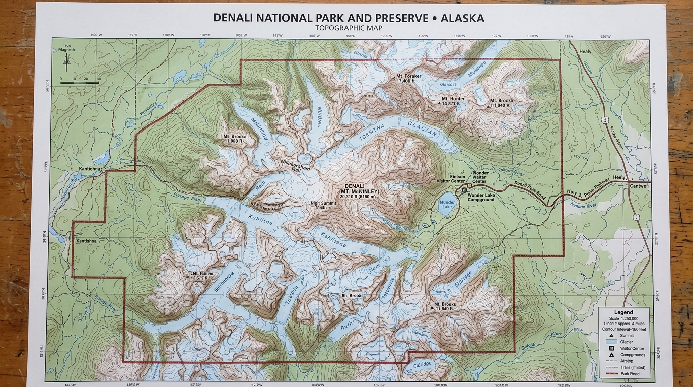
Planning a trek into the remote backcountry of Alaska requires much more than a casual tourist brochure or digital smartphone download. A reliable Denali National Park topographic map acts as an indispensable safety instrument for anyone stepping away from the main park road into the vast wilderness. Because the park spans over six million acres of mostly roadless land, travelers encounter immense terrain with virtually no maintained trail systems. Without proper navigation tools, hikers can quickly become disoriented across open tundra expanses and rugged mountain corridors.
Many modern visitors mistakenly rely entirely on phone apps or digital navigation tools for orientation. However, cellular service does not exist across the vast majority of Denali National Park, rendering digital downloads useless once travelers move away from the entrance area. A physical paper map ensures that adventurers maintain constant access to vital geographic data, regardless of battery depletion or signal loss. Understanding how to interpret this cartographic data helps visitors plan realistic daily routes and identify potential hazards across the changing landscape.
Why Crossing Denali’s Roadless Tundra Requires Cartographic Precision
A Denali National Park topographic map keeps travelers safe because the park features very few official paths and zero cell coverage.
When explorers venture into a landscape with minimal trail infrastructure, personal navigation skills determine whether a trip succeeds or turns dangerous. Denali National Park features massive river valleys, dense brush, and steep mountain passes that demand rigorous planning before departure. Carrying a physical topographic map lets hikers track their exact position by matching surrounding peaks, ridges, and valleys with printed contour lines. According to the National Park Service, backcountry visitors must always carry appropriate maps and demonstrate familiarity with compass navigation before entering remote regions.
Interpreting Glacial Valleys and Steep Alaskan Slopes
Reading the contour lines on a Denali National Park topographic map helps outdoor enthusiasts spot steep drop-offs, massive glaciers, and braided rivers before attempting difficult crossings.
Contour lines reveal the true shape and steepness of the land by connecting points of identical elevation across the sheet. When lines sit tightly packed together on the paper, they indicate a sheer cliff or a jagged rock ridge that may be impossible to traverse on foot. Conversely, when contour lines spread far apart, the terrain opens into wide gravel riverbeds or rolling tundra plains that are much easier to traverse. Hikers must also monitor glacial streams shown on the chart, as these waterways shift channels frequently and can rise rapidly during warm afternoon melts or summer rainstorms.
Selecting Backcountry Unit Grids and Cartographic Scales
Travelers should look for official topographic maps that cover their assigned backcountry unit so they can review critical elevation changes clearly.
Denali National Park divides its vast wilderness into distinct geographical units, and each individual unit maintains specific visitor regulations and strict capacity limits. A detailed topographic map allows backpackers to inspect the exact borders of their designated unit and plan their daily mileage safely. Standard topographic maps often utilize a 1:63,360 scale, where one single inch on the printed page represents one full mile on the ground. Choosing a map scale that matches your travel style ensures you can spot minor terrain features like hidden gullies and steep ravines.
Acquiring Authorized Maps at Park Centers and Online Outlets
According to the National Park Service, visitors can purchase reliable topographic maps online in advance or directly at park visitor centers upon arrival.
Travelers can acquire official topographic sheets through authorized educational partners like Alaska Geographic before leaving home. Purchasing maps early allows hikers to study the terrain, mark potential campsites, and map out emergency exit routes well before their trip begins. For those who prefer picking up materials locally, the Denali Visitor Center and the Wilderness Access Center carry a wide selection of topographic sheets and park guides. Park rangers at these facilities can also provide vital real-time updates regarding trail conditions, bridge availability, and river levels.
Shielding Cartographic Materials From Severe Weather Realities
Paper maps can easily tear or become completely soaked in wet weather, making a waterproof case or protective plastic bag essential for your Denali National Park topographic map.
Alaskan weather patterns are famously unpredictable, bringing sudden rainstorms, high winds, and wet snow even during peak summer months. A standard paper map will quickly disintegrate if it gets saturated in a heavy downpour or dropped into a rushing glacial stream. Adventurers should fold their maps carefully to display their active route and store them inside durable waterproof sleeves. For those planning extended wilderness routes in nearby regions, checking out resources like a glacier national park backcountry map can also offer great insights into mountain navigation and safety preparation.
Frequently Asked Questions
Do I need a topographic map for short walks near the park entrance?
Short frontcountry walks near the visitor center feature well-maintained gravel paths where a topographic map is not strictly necessary. However, anyone venturing off the designated trails into the open tundra should always carry one.
Can I rely on my cell phone GPS instead of a paper map?
Cell service is unavailable across the vast majority of Denali National Park, making offline GPS apps unreliable if your device loses power or signal. A physical topographic map serves as a foolproof backup that never depends on battery power.
Where are official Denali topographic maps sold?
Official topographic maps are available online through park partner organizations and physically at the Denali Visitor Center and Wilderness Access Center upon arrival.
What scale is best for backcountry hiking in Denali?
Standard 1:63,360 scale topographic maps are widely used because they provide a clear balance of broad landscape views and necessary terrain detail for route finding.
How do I protect my paper map from rain and wind?
Placing your topographic map inside a waterproof map case or a sturdy ziplock bag prevents moisture damage during heavy rain or river crossings.
Are trails clearly marked throughout Denali National Park?
Denali National Park has very few maintained trails, meaning most backcountry exploration requires cross-country navigation using a topographic map and compass.
Disclaimer: Park rules, map availability, and backcountry regulations can change over time. Always verify current conditions and safety guidelines directly with the National Park Service before starting your trip.

I’m Muhammad Ubaid, founder of YBR Magazine. I research and write detailed guides on America’s National Parks — covering entry fees, permits, best times to visit, and planning tips — using official NPS sources and up-to-date information.

