

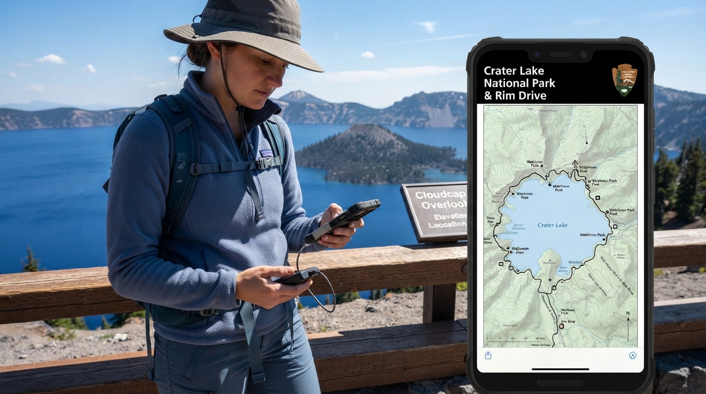
Planning a trip to Oregon’s famous volcanic landscape requires careful preparation because digital navigation tools often fail once you enter the remote mountain territory. Many travelers look specifically for a crater lake national park map pdf before they leave home so they can view trail layouts, scenic drives, and visitor facilities without relying on a live internet connection. Because mobile data signals drop out completely across large portions of the Cascade Mountains, having a saved digital document on your phone or tablet is an essential part of trip planning.
Where to Find the Official Crater Lake National Park Map Pdf
You can download current trail guides, park brochures, and road maps directly from the official National Park Service website before your trip.
Finding a reliable and accurate map file starts with visiting official government resources rather than random third-party travel blogs that might host outdated versions. The National Park Service provides official digital brochures and specialized trail guides that visitors can save directly to their devices. These official documents are regularly updated to reflect current park boundaries, open facilities, and designated campgrounds. Travelers should always check the primary park website before downloading any file to ensure they have the most recent edition available.
Understanding What the Digital Map Shows You

The standard park map highlights major scenic viewpoints, visitor facilities, and the main roads that loop around the lake.
When you open your saved document, you will see Rim Drive, which is the primary thoroughfare circling the caldera. The map points out major viewpoints like Watchman Peak and Cloudcap, along with parking areas and restrooms. It also details the steep hiking trails that descend down to the water or climb up to higher mountain peaks. For visitors looking to expand their itinerary, reviewing resources such as top hiking routes around Crater Lake can provide extra context on what various symbols and trail ratings mean.
Why You Need an Offline Map Before Entering Crater Lake
Cell phone service is unreliable or completely unavailable in many parts of Crater Lake National Park, meaning you must save your PDF file beforehand.
The deep volcanic caldera and dense surrounding forests create massive dead zones where mobile networks cannot reach. If you attempt to load a map website or use a live navigation app upon arrival, you will likely encounter a blank screen and a spinning loading icon. Downloading the document to your local storage while you still have reliable Wi-Fi or strong cellular service eliminates this risk. Once saved, your device can open and display the file anytime without needing any cellular towers or internet data.
Practical Limitations of Using PDF Maps on Your Phone
Relying solely on a digital screen comes with practical risks like battery drain and screen glare that a physical paper map avoids.
Even though digital files are convenient, mobile devices have distinct physical limitations in alpine environments. Bright sunlight reflecting off high-altitude snow or open water can make phone screens very difficult to read. Furthermore, cold mountain temperatures drain lithium-ion batteries much faster than normal, leaving you vulnerable to a dead phone screen when you need navigation the most. Static PDF files also do not provide real-time blue-dot GPS tracking on custom park trails unless you are using a specialized mapping application rather than a basic document viewer.
Seasonal Road Closures and Map Accuracy
According to the National Park Service, heavy snow keeps parts of Rim Drive closed for much of the year, so your static PDF map will not show daily road openings.
Crater Lake experiences some of the heaviest snowfall in the United States, which directly impacts how visitors travel around the rim. While a standard downloaded document shows the entire 33-mile Rim Drive loop, large segments of that road remain closed by snow well into July or even August. A static file cannot display which gates are open on any given morning. Visitors must always verify current road status updates with park rangers or official park bulletin boards upon arrival, as digital map files only show permanent geography rather than daily weather conditions.
Frequently Asked Questions About Crater Lake Map Downloads
These quick answers help you solve common problems with downloading and using your park maps.
Can I print out the Crater Lake National Park Map PDF at home?
Yes, you can easily print the document on standard letter-sized paper using a home printer, though some text and fine trail details may appear smaller than on the official oversized paper brochures.
How much storage space do I need for the map file?
Most official park brochure files are relatively small, typically ranging between five and fifteen megabytes, meaning they will easily fit on almost any smartphone or tablet.
Will my PDF map show my exact live GPS location?
A basic PDF viewer will only display the document pages and will not show a live tracking dot, so you must use visual landmarks to figure out where you are on the map.
Are there maps available for download in languages other than English?
The National Park Service frequently provides translated overview brochures for international visitors on their official digital planning pages.
What should I do if my phone battery dies while using the digital map?
Always carry a physical paper backup map from a visitor center or keep a fully charged portable power bank in your backpack to prevent getting stranded without directions.
Do I need to pay a fee to download the official park map?
No, all official National Park Service digital brochures and maps are entirely free to download from their public website.

I’m Muhammad Ubaid, founder of YBR Magazine. I research and write detailed guides on America’s National Parks — covering entry fees, permits, best times to visit, and planning tips — using official NPS sources and up-to-date information.

