

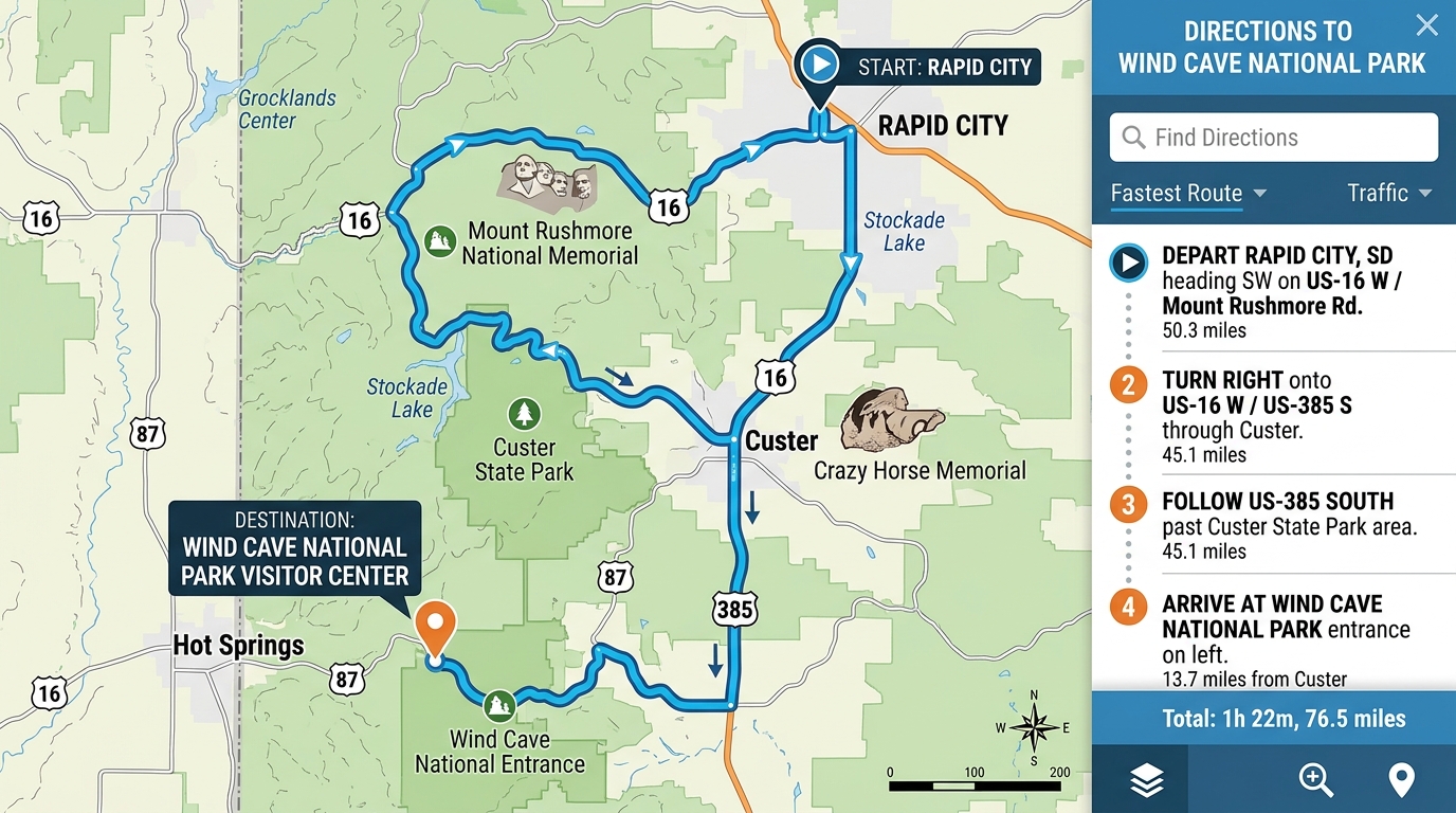
Finding your way to Wind Cave National Park involves navigating the winding, forested roads of southwestern South Dakota rather than pulling off a bustling interstate highway. Because the park sits quietly tucked away in the southern expanse of the Black Hills, travel planning requires a firm grasp of local state highways and smaller federal routes. Visitors often find that traditional cross-country transit plans fall short once they leave major multi-lane roads, making specific landmark navigation and highway numbers essential for a smooth arrival. Understanding the unique layout of the surrounding terrain helps travelers avoid common missteps, such as confusing park boundaries with nearby town centers or taking unpaved forest shortcuts.
Getting to Wind Cave National Park from Nearby Towns
Reaching Wind Cave National Park from local hubs like Custer or Hot Springs relies on a few key paved highways that lead straight to the park gates.
Travelers coming from the south typically depart from Hot Springs and head roughly ten miles north along US Highway 385, which cuts directly through the heart of the park. Visitors arriving from the north or west usually travel via US Highway 16 Alternate before connecting to US Highway 385 south through the historic town of Custer. According to the National Park Service, these primary roadways remain paved and open year-round, though winter weather can occasionally bring temporary closures or icy conditions. Drivers should keep a close eye out for wandering wildlife and sudden speed limit drops as the open prairie transitions into protected park land.
Reaching Wind Cave National Park from Rapid City Regional Airport
Flying into the region and driving south from Rapid City Regional Airport offers a direct aerial-to-roadway transition for out-of-state visitors.
Rapid City Regional Airport sits roughly fifty miles northeast of the protected underground networks and serves as the closest major commercial aviation facility for this portion of the Black Hills. Leaving the airport terminal, drivers typically head west toward South Dakota Highway 79 and travel south toward Hot Springs along the edge of the rolling plains. Upon reaching the outskirts of Hot Springs, motorists transition onto US Highway 385 north, which delivers vehicles straight to the southern entrance of Wind Cave National Park in about one hour under clear weather conditions. Travelers should account for possible construction delays during the peak summer tourist season, which can add unexpected minutes to the drive time.
Navigating Inside the Park and Finding the Visitor Center
Once vehicles cross the official park boundary signs, locating the primary Visitor Center requires following specific brown directional markers rather than relying on general park acreage.
Visitors frequently make the mistake of assuming cave tours begin immediately upon entering the park limits, but underground excursions actually depart exclusively from the main Visitor Center situated along US Highway 385. Drivers must follow the posted brown and white park signs to turn into the designated Visitor Center parking lot, where ticket windows and exhibits are housed. The paved surface roads winding away from the visitor hub also double as prime viewing areas for free-roaming bison herds and prairie dog towns that sit right alongside the asphalt. For those planning a broader itinerary around the region, reviewing our guide on things to do in Wind Cave National Park offers helpful context for balancing underground tours with surface exploration.

Important Driving Tips and GPS Warnings for the Black Hills
Relying completely on digital mapping software or smartphone navigation apps inside the Black Hills can create serious navigation hazards for drivers.
Cell phone coverage throughout remote valleys and heavily wooded canyons in southwestern South Dakota is notoriously spotty, often cutting out entirely and leaving navigation apps frozen mid-route. Standard GPS units frequently attempt to save distance by routing unsuspecting drivers onto rugged gravel logging trails, narrow fire lanes, or unpaved maintenance roads that require high-clearance vehicles. To prevent vehicle damage or getting lost in remote areas, motorists should always keep a physical paper road map in the glove box and rely primarily on physical highway mileage markers. Furthermore, sudden summer thunderstorms or heavy winter snowfalls can turn dirt tracks impassable within minutes, making adherence to paved state highways the safest practice.
Frequently Asked Questions
What is the primary highway that runs through Wind Cave National Park?
US Highway 385 runs directly north and south through the park boundaries, serving as the main paved corridor for all incoming traffic.
How long does the drive take from Rapid City Regional Airport?
The drive from Rapid City Regional Airport takes approximately one hour, covering roughly fifty miles mostly along SD Highway 79 and US Highway 385.
Can I rely on my smartphone GPS to find the park?
Smartphone GPS apps can be unreliable due to patchy cell service in the Black Hills and may mistakenly route vehicles onto rough gravel logging roads.
Where do the underground cave tours actually start?
All ranger-led underground cave tours begin at the main Visitor Center located directly off US Highway 385, rather than at random points along the park borders.
Is cell phone service dependable near the park entrance?
Cellular reception is generally weak or completely absent across large portions of the park and surrounding national forest lands, so printed maps are strongly recommended.
What kind of animals might I see while driving on park surface roads?
Drivers frequently encounter free-roaming bison, pronghorn antelope, and prairie dogs grazing right next to the paved roadways.
Are park roads paved throughout the entire area?
The main arteries like US-385 and SD-87 are fully paved, but minor backcountry paths and surrounding forest service routes consist of gravel or dirt.

I’m Muhammad Ubaid, founder of YBR Magazine. I research and write detailed guides on America’s National Parks — covering entry fees, permits, best times to visit, and planning tips — using official NPS sources and up-to-date information.

