

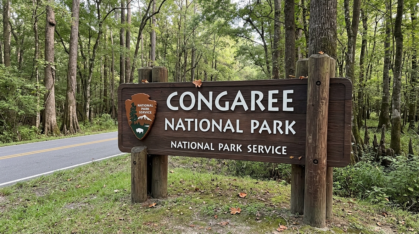
Travelers planning a South Carolina nature excursion often look forward to spotting the primary Congaree National Park Sign to kick off their outdoor journey. Finding this exact milestone marker can sometimes confuse first-time guests because the swamp protection area spans a massive floodplain without massive commercial highway arches at every boundary. Whether you want to capture a classic keepsake photo or simply confirm you have arrived at the correct forest destination, knowing where to look makes the driving trip much smoother. Beyond the entrance marker itself, a successful outing requires understanding the local wetland terrain, seasonal weather patterns, and where to rest after a long day of boardwalk hiking.
Pinpointing the Official Entrance Marker
The official Congaree National Park Sign sits near the main entrance on National Park Road, just off Old Bluff Road in Hopkins, South Carolina.
Visitors driving from Columbia will typically head southeast and follow posted route signs toward the Harry Hampton Visitor Center. The primary welcome sign stands near the paved parking area close to the main visitor center entrance. According to the National Park Service, arriving via this main route ensures you pass the most prominent monument markers and have immediate access to park maps, indoor restrooms, and ranger assistance. Secondary park borders touch remote rural roads, but those back entrances rarely feature large welcome structures, making the visitor center area the most reliable spot for a traditional photo.
Composition Guidance for Milestone Photos
Capturing a clear picture of the Congaree National Park Sign requires a bit of timing and patience to avoid crowded peak hours.
Morning sunlight offers the softest shadows and the most natural colors without harsh midday glare hitting the dark wood and carved lettering. Visitors should park in designated visitor center stalls rather than stopping along the narrow road shoulder, as traffic can move unexpectedly fast on rural curves. Stepping back slightly allows you to frame the surrounding floodplain trees in the background, giving your keepsake snapshot a true sense of the ancient bottomland hardwood forest you are about to explore.
Evaluating the Floodplain Ecosystem Experience
Deciding if the journey into this South Carolina swamp land fits your vacation style depends entirely on what kind of outdoor environment you enjoy.
Congaree National Park protects the largest tract of old-growth bottomland hardwood forest left in the United States, famous for its towering champion trees and peaceful swamp boardwalks. According to the National Park Service, the park shines brightest for hikers, birdwatchers, and paddlers who appreciate quiet wetland ecosystems rather than towering mountain peaks or deep canyons. Visitors should keep in mind that the landscape is flat and heavily forested, meaning panoramic mountain vistas are entirely absent. If you enjoy slow-paced nature walks and unique aquatic habitats, the protected floodplain offers a rewarding and unusual escape.
Local Lodging and Rural Accommodations
Planning overnight stays requires careful booking because the park itself features no commercial lodging and only limited backcountry camping.
Visitors who prefer a cozy, historic atmosphere often search for a comfortable bed and breakfast near Congaree National Park located in nearby rural communities or downtown Columbia. Staying locally allows travelers to enjoy a hearty homemade breakfast before driving to the trailhead and gives them a quiet place to unwind away from busy highways. Because options close to the park boundaries are limited, reserving local accommodations well in advance is always recommended.
Logistical Hurdles and Environmental Hazards
Every national park trip comes with a few logistical challenges that require careful preparation before you leave home.
According to the National Park Service, Congaree National Park experiences severe mosquito populations during the warm spring and summer months, making heavy bug spray or protective clothing an absolute necessity. Additionally, seasonal heavy rains frequently flood low-lying trails, closing popular paths like the Boardwalk Loop until water levels recede safely. Cell phone service can also become spotty or disappear entirely once you get deep inside the park boundaries, so downloading offline maps beforehand prevents unnecessary navigation frustration.
As you prepare for your travels, keeping track of every landmark and milestone helps preserve your favorite memories. For travelers who want to maintain an organized record of their trips, you can use a handy log for tracking US park adventures to document each destination easily.
Frequently Asked Questions About Visiting
Where is the main entrance sign located?
The main welcome sign is located near the Harry Hampton Visitor Center off Old Bluff Road in Hopkins, South Carolina.
Is there an entrance fee to visit?
According to the National Park Service, entering the park is completely free, though certain guided tours or group camping permits may carry separate fees.
Can I camp inside the park?
Primitive backcountry camping is available with a valid permit, but there are no developed campgrounds with RV hookups inside the park boundaries.
Are pets allowed on the trails?
Leashed pets are permitted on most park trails, but owners must clean up after them and keep them under physical control at all times.
What is the best time of year to visit?
Spring and autumn offer the most comfortable daytime temperatures and lower mosquito activity compared to the hot, humid summer months.
How long should I plan to stay?
Most visitors spend between a half-day and a full day exploring the boardwalk trails, visiting the visitor center, and walking among the giant trees.

I’m Muhammad Ubaid, founder of YBR Magazine. I research and write detailed guides on America’s National Parks — covering entry fees, permits, best times to visit, and planning tips — using official NPS sources and up-to-date information.

